Deploying Ground Truthing Sensors in Parks and Trails


A practical guide to site selection and sample sizing for training AI visitation models in urban spaces
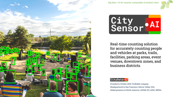
As urban planners and parks departments increasingly turn to artificial intelligence and big data to understand community mobility, a fundamental truth remains: the digital world must be anchored in physical reality. At CityData.AI, our Gravity AI model processes billions of crowdsourced mobility signals to infer place visitation and movement trends. However, AI models do not operate in a vacuum. To achieve the highest possible accuracy, these digital inferences require physical validation.
Ground truthing—the practice of collecting real-world verification data on-site—provides the baseline necessary to calculate precise "expansion factors". This allows us to scale crowdsourced mobile data to represent the total population accurately. Whether you are utilizing our permanent CitySensor hardware or conducting manual surveys using the free CitySurvey mobile app, the strategy behind your deployment is just as critical as the technology itself.
To help municipal agencies navigate this process, we have compiled a comprehensive guide on sensor deployment strategies, covering everything from portfolio selection to privacy compliance.
1. Strategic Park Selection: Stratifying Your Portfolio
When managing a large portfolio, you cannot—and do not need to—install a permanent sensor in every single park. The goal is to capture a representative sample that allows the Gravity AI model to learn the unique behavioral coefficients of different park typologies.
Consider a hypothetical city with a system of 100 parks, broken down as follows:
- 20 Regional Large Parks (City-wide draw)
- 50 Mid-Sized Parks (25% located in high-density neighborhoods)
- 30 Small Neighborhood Parks (85% located in high-density neighborhoods)
To decide where to install sensors, you must use a stratified sampling strategy. The Gravity model relies on variables like park area, amenities, and the population demographics of the surrounding census blocks. Therefore, your sensor deployment must reflect these diverse "mass" and "distance" inputs.
Instead of randomly placing sensors, you should distribute them proportionally:
- Regional Parks: Select the top anchor parks that drive the most diverse weekend traffic.
- Mid-Sized Parks: Ensure you split your deployment between the high-density urban core (where foot traffic dominates) and lower-density suburbs (where vehicular access is higher).
- Small Parks: Focus heavily on those embedded in the 85% high-density zones, as these act as critical daily micro-hubs for local residents.
By capturing ground truth across these distinct profiles, the AI learns how a small urban pocket park behaves differently from a sprawling regional reserve, allowing it to accurately infer visitation for the unmonitored parks in your system.
2. The Magic Number: Minimum Sample Size for Gravity AI
How many parks constitute a minimum sample for training the Gravity AI model? Our methodology relies on achieving high-confidence ground truth data for approximately 30% of the parks in a given portfolio. This 30% acts as the foundation; the model uses the relationships learned here to scale and predict visitation for the remaining 70% of unmonitored locations.
In our 100-park example, ideally, you would want ground truth data for 30 locations. However, we recognize that municipal budgets are often constrained. If purchasing 30 permanent hardware sensors is not feasible, we advocate for a hybrid deployment strategy.
For instance, a city could opt to lease permanent hardware sensors—which reduces upfront capital expenditure to roughly $150 per sensor per month, covering hardware, cellular connectivity, and cloud storage. If a city leases 6 permanent sensors for their highest-priority regional parks, they can supplement the remaining 24 locations using the free CitySurvey mobile app. This approach allows cities to achieve the critical 30% sample threshold by combining continuous automated data with strategic, manual mobile surveying.
3. The Physics of Installation: Elevation and Angle
The physical orientation of a sensor dictates the quality of the computer vision data it captures. The goal is to maximize the field of view while minimizing "occlusion"—the phenomenon where people standing close to the camera block the view of people further away.
For Mobile App Surveys (CitySurvey): Handheld recording is not reliable. The smartphone must be mounted on a tripod at a standard height suitable for capturing people walking. The device must remain completely stable and stationary during the entire 2 to 3-hour session.
For Permanent Hardware (CitySensor): Permanent sensors should be mounted on rigid, city-owned infrastructure like lighting poles or facility walls. They should be installed at an elevation of 12 to 15 feet. This elevated, downward-angled vantage point allows the AI to track bounding boxes over a wider area without pedestrians obscuring one another. The wide-angle 50 MP lens is designed to detect people as close as 5 meters and as far away as 200 meters.
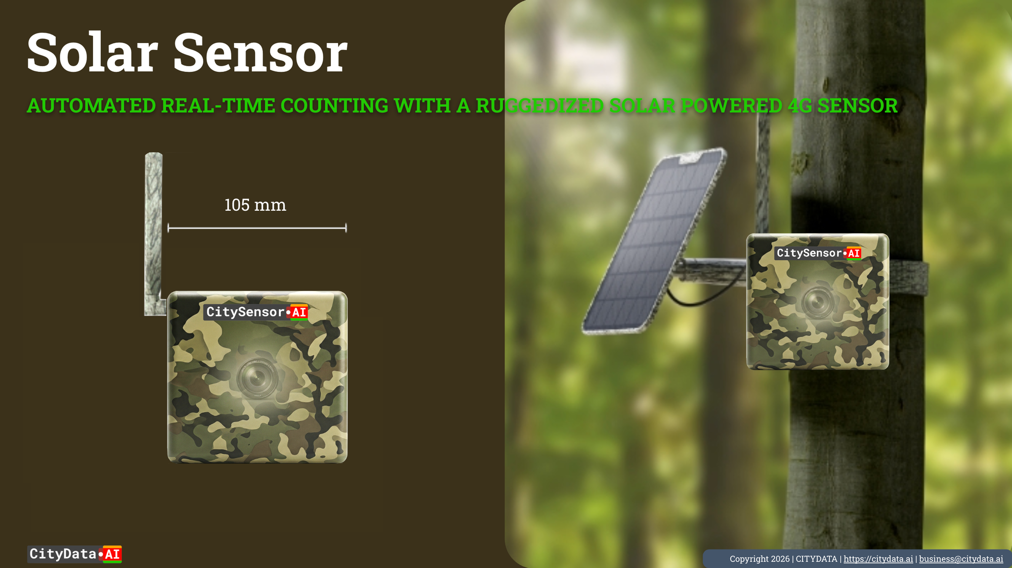
4. Powering the Edge: Connected vs. Solar
CitySensor is available in rugged weatherproof formats requiring continuous power, as well as self-sufficient solar-powered formats. The choice between the two depends entirely on the deployment environment:
- Connected Power: For downtown zones, business districts, and developed mid-sized parks, hardwired sensors are ideal. These units require connection to a powered outlet. Tying into a streetlight's photocell or a facility's mains power ensures uninterrupted, 24/7 computing performance.
- Solar-Powered: Natural resources, sprawling regional parks, and remote trailheads often lack accessible electrical grids. Trenching power lines to these locations is cost-prohibitive. In these scenarios, the solar sensor—equipped with a 6W attached solar panel and a 6000mAh rechargeable battery—provides an autonomous, off-grid solution.
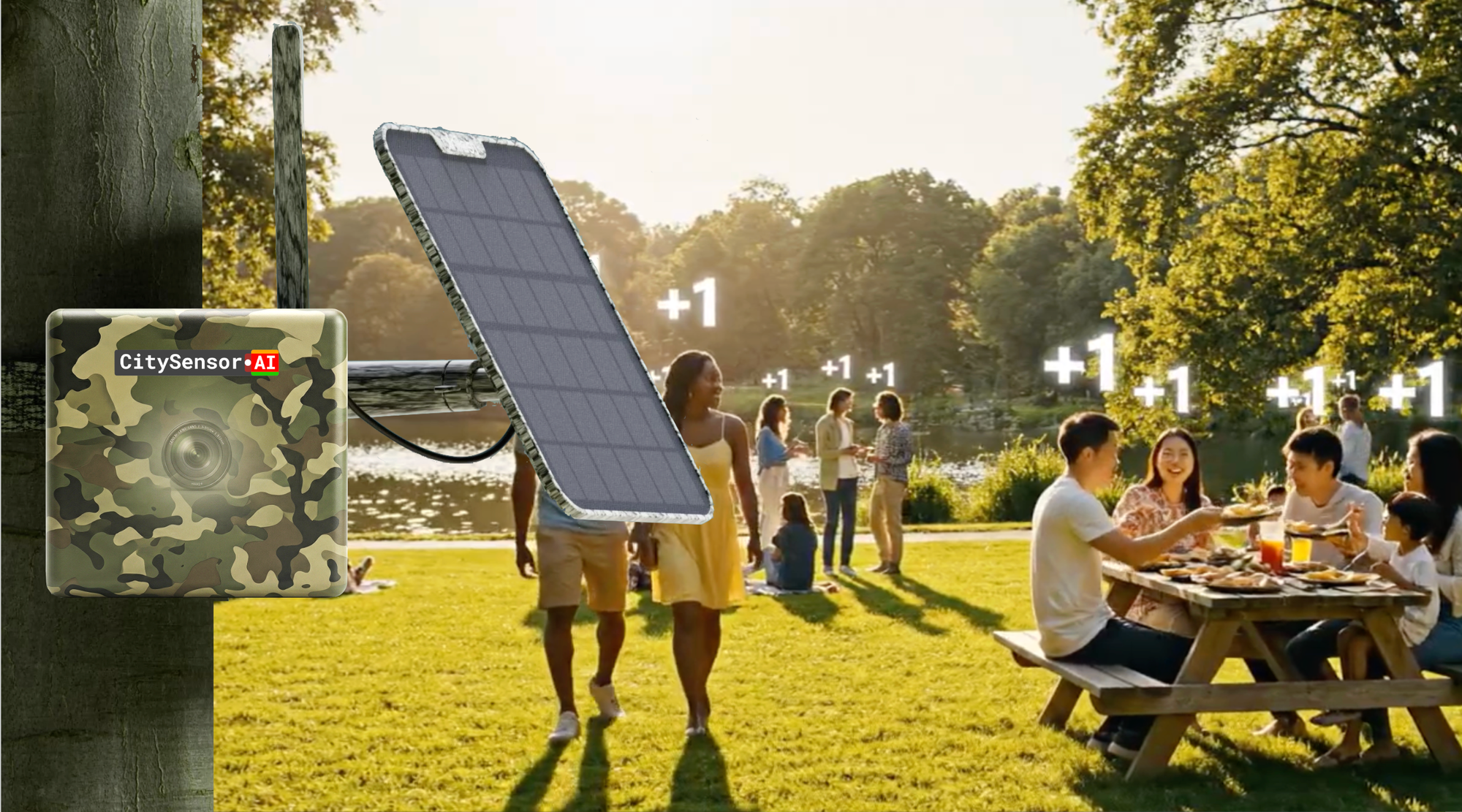
5. Pinpointing the Hotspots: Where to Install Within a Park
A common misconception is that sensors should be placed at the park gates. Our field data collection protocol explicitly advises against this: Do not place the device at park gates or access points. Entrances capture temporary, transitional movement that often fails to reflect actual park usage or "dwell time".
Instead, the strategy must target the "Busy Hub". Sensors should be positioned with a wide-angle view overlooking central plazas, main playgrounds, or primary trail intersections. The camera requires an unobstructed view of the most active pedestrian movement. By monitoring where people actually congregate, dwell, and interact, the AI gathers a much more meaningful representation of the park's utility to the community.
6. Navigating the Linear: Trails and Trailheads
While parks are polygonal spaces that require "hub" monitoring, trails are linear networks. For trails and trailheads, the deployment strategy fundamentally changes.
In linear environments, entrances do function as critical chokepoints. A sensor deployed at a primary trailhead can capture nearly 100% of the foot and bicycle traffic entering and exiting the network. The object tracking capabilities of the AI can distinctly count and classify both pedestrians and bicyclists moving along the path. For sprawling, multi-access trail networks, combining a permanent solar sensor at the main trailhead with periodic mobile surveys at secondary access points ensures comprehensive data capture.
7. Scaling for Surge: Events, Festivals, and Fairs
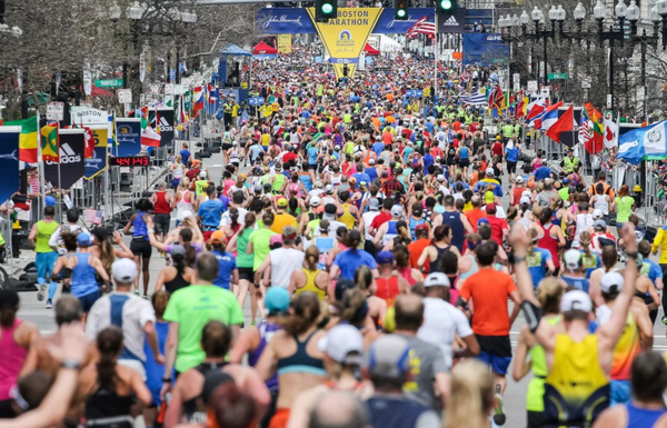
Events—from weekend farmers' markets to massive fireworks celebrations—create localized macro-surges in attendance. Capturing these anomalies is vital, as park usage is typically much higher on weekends and during major events.
To effectively measure attendance and engagement during these surges, your sampling schedule must be intentional. For manual mobile surveying, we recommend conducting sessions for 2 to 3 hours at a time. To capture the full lifecycle of an event, a highly effective approach is to begin sampling at 1:00 PM and continue through 8:00 PM.
This schedule allows you to:
- Capture baseline, non-peak activity (1:00 PM to 3:00 PM).
- Monitor the ramp-up as crowds arrive (3:00 PM to 5:00 PM).
- Measure peak event activity (5:00 PM to 7:00 PM).
- Track the ramp-down as visitors disperse (through 8:00 PM or 9:00 PM).
Furthermore, capturing seasonal variation is critical to maintaining a high-quality dataset. We recommend ensuring that manual sampling occurs across different seasons—specifically in March, June, September, and December—to account for weather-driven behavioral shifts.
8. The Ethical Imperative: Total Privacy Compliance
As we deploy optical sensors into public spaces, we must confront the ethical implications of digital monitoring. CityData.AI operates on an unwavering principle: public safety and operational intelligence must never come at the expense of individual liberty.
All of our deployment strategies and technologies are completely privacy compliant. The edge-computing AI utilized by CitySensor features no facial recognition capabilities. The system does not capture, process, or save identifiable human faces. It relies on a "heatmap" approach, recognizing only the shape and form of objects—such as persons, bicycles, or vehicles—to quantify visits.
Images are utilized strictly for establishing numerical counts and verifying environmental conditions, ensuring that your community can enjoy public spaces without the threat of personal surveillance.
Final Thoughts
Deploying a sensor network is not simply an IT exercise; it is an urban planning strategy. By carefully stratifying your portfolio, adhering to minimum sample requirements, utilizing the correct hardware formats, and targeting the actual hubs of human activity, you provide the Gravity AI model with the exact physical anchors it needs. The result is a highly accurate, fully privacy-compliant mobility digital twin that empowers your agency to plan, budget, and operate with absolute confidence.