CitySim Predictive Flow Simulations in Varanasi, India
Authored by Dr. Pieter Fourie with Team CityData.AI
Authored by Dr. Pieter Fourie with Team CityData.AI

Celebrating our 6th consecutive year alongside the industry’s giants—bootstrapped, profitable, and powered by innovation. In the rapidly evolving landscape of the public sector, technology has ceased to be a luxury—it is now the very backbone of effective governance. From small municipalities to sprawling state agencies, government leaders

The Ultimate Guide to the World’s Most Epic Highs and Lows If you are reading this, you probably have an itch that only a pair of worn-in hiking boots and thin mountain air can scratch. We’ve all seen the standard travel brochures, but at CityData, we believe the
The Executive Playbook for Rescuing High-Value Customer Engagements Introduction: The High Stakes of Enterprise and Government Churn In the complex ecosystems of enterprise and government contracting, the loss of a customer—or churn—is not a simple line item on a balance sheet. It is a seismic event with compounding

Establishing a Baseline for Park Visits The estimation of park visitation necessitates a foundational understanding of each park's intrinsic capacity and appeal. The nine park and recreation assets in Kenosha County managed by the county system are not homogenous; they represent a diverse portfolio of recreational infrastructure, natural

CityData captures, measures, and estimates crowd sizes for large events like fireworks celebrations, farmers markets, music concerts, sporting events, religious events, political rallies and protests. CityData offers two solutions for estimating crowd size. Solution 1: CitySensor CitySensor is a ruggedized hardware sensor connected to an online dashboard for accurate real-time

CityData has studied, analyzed and evaluated the universe of computer vision AI models so you don't need to! 1. Executive Summary The accurate and automated estimation of crowd sizes, particularly in scenarios involving thousands of individuals captured from aerial platforms such as drones, helicopters, or satellites, presents a
A hybrid spatio-temporal model for hourly place visitation estimation in geographically-distributed parks and public spaces by leveraging multi-source data and confidence weighting Abstract Accurate, fine-grained visitation data is crucial for park management, urban planning, and resource allocation. Traditional methods, such as manual counting or permanent sensor installation, are often costly

KABOOM! and CityData.ai unveil county-wide parks visitation trends 1. Introduction Parks and playgrounds are the vibrant arteries of our communities, fostering health, well-being, and vital social connections. In Prince George's County, Maryland, a dynamic collaboration between the national non-profit KABOOM! and CityData.ai is revolutionizing how we

New playgrounds lead to increased engagement and positive community impact. In the heart of the Texas Hill Country, Uvalde — famously known as the "Honey Capital of the World" for its exquisite huajillo honey and stunning natural landscapes — holds a special place. Beyond its allure for outdoor enthusiasts enjoying

In today's data-driven world, economic development hinges on understanding the intricate visitation and movement patterns within our cities. To truly revitalize downtown zones, commercial areas, and business districts, cities need to understand the intricate dance of human movement. Mobility intelligence provides the detailed choreography, transforming raw data into

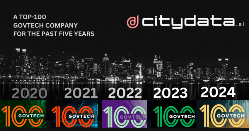
GovTech 100 list for the sixth consecutive year is a testament to the company's innovation, growth, and impact in the government technology vertical! We're thrilled to announce CITYDATA.ai has been named to the prestigious GovTech 100 list for the sixth consecutive year! This remarkable achievement
uam
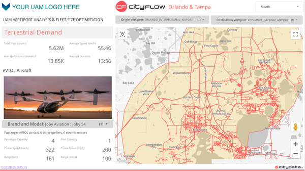
My previous blog post, "Ideal Take-off and Landing Spots for eVTOLs," explored the crucial first step in realizing the potential of Urban Air Mobility (UAM): identifying optimal locations for vertiports. We delved into the factors influencing vertiport placement, considering aspects like proximity to demand centers, airspace regulations, and

parks and recreation
Understanding visitation patterns to various points of interest (POIs) like parks, trails, downtowns, business districts, shopping malls, restaurants, and individual businesses is crucial for urban planning, economic development, and tourism. Anonymized GPS crowdsourced data offers a rich source of information for measuring these visits and dwell times. However, this data
cityflow
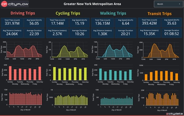
Understanding city-wide mobility patterns is crucial for effective urban planning. CITYFLOW.ai leverages GPS mobility data to provide a powerful lens into these patterns. However, the data represents a sample of the population, not the entire city. This blog post delves into the technical process of scaling up trip counts

uam
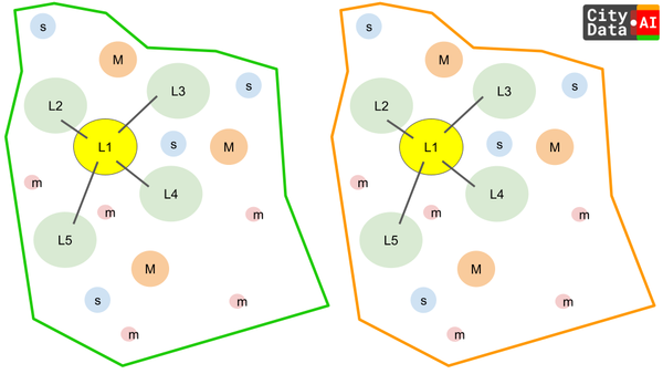
A Scientific Approach to Vertiport Site Selection for Urban Air Mobility using CITYSIM Imagine a future where buzzing electric vehicles weave through cityscapes, whisking passengers between rooftops. This vision of Urban Air Mobility (UAM) promises to revolutionize transportation, but its success hinges on strategically placed vertical take-off and landing locations,
geofence
Abstract: Geofences are the cornerstones of spatial analysis, underpinning applications from park visitation to customer foot traffic measurement. However, inferences about visits become particularly intricate at the geofence's edge. This article delves into these challenges, exploring the factors that inflate visit counts and proposing best practices for accurate

CITYPARKS
How CITYDATA.ai is shaping urban regeneration to help reimagine Monterrey's parks and green spaces. Monterrey, the bustling capital of Nuevo León, Mexico, is undergoing a transformation. The city's local government is leveraging the power of big data and artificial intelligence (AI) from CITYDATA.ai to
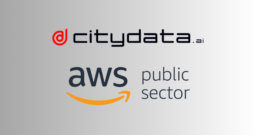
We are thrilled to announce our official certification as an AWS Public Sector Partner (PSP)! This exciting development signifies our commitment to providing innovative cloud solutions tailored to the unique needs of government agencies, space programs, educational institutions, and non-profit organizations. What Does This Mean? As a certified AWS Public
smartcity
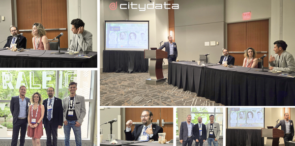
We had the incredible opportunity to host a panel discussion at Smart Cities Connect on "Data + AI for Revitalizing America's Parks Systems." We explored how data and AI can transform our parks into vibrant hubs that meet the evolving needs of our communities. 🌳📈 Key takeaways from
smartmobility
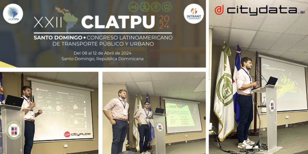
Nos complace compartir que CITYDATA.ai tuvo la oportunidad de participar en el XXII Encuentro de los Congresos Latinoamericanos de Transporte Público y Urbano (CLATPU) que se llevó a cabo en Santo Domingo, República Dominicana, organizado por el Instituto Nacional de Tránsito y Transporte Terrestre 🚌🚦 En el marco de este
citydata
We are thrilled to announce that we have been named to the GovTech 100 list for the fifth consecutive year! This prestigious award recognizes companies that are leading the way in innovation for the public sector, and we are honored to be included among such a distinguished group. The GovTech

camel
The Bactrian Camel isn't pretty to the conventional eye. With two oddly large humps, heavy shaggy fur, an industrious gait, and an assiduous expression, you are likely to walk right past this beast at your local zoo. Found in the Eurasian Gobi Desert in southwest Mongolia in an
geoawesomeness
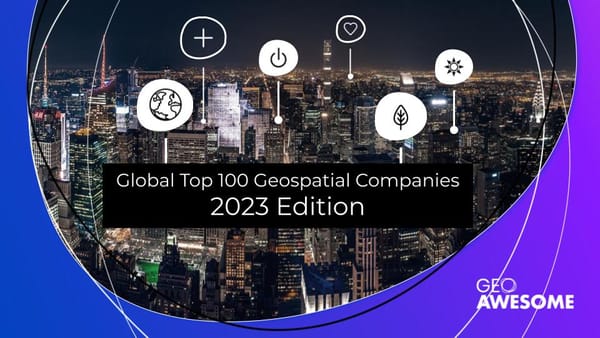
CITYDATA is Geoawesome! Geoawesomeness announced that CITYDATA is in their Global Top 100 Geos for 2023. This is an annual list of the best geospatial companies in the world as determined by an expert committee after reviewing hundreds of companies. The 16 industry luminaries on the expert committee included Dr.