The real-world knowledge graph for your city
I recollect the conversation from June 2016 with extraordinary clarity. We had begun our exploratory session with Tony Batalla, CIO at the City of San Leandro. Keen to understand if CityDash could expand beyond the analysis of 311 civic issues, I kept asking Tony about analyzing and visualizing additional datasets like people movement and crime reports. Tony's insightful feedback to me was:
"Honestly, there are too many visualization tools out there. We don't need more dots on a map. The holy grail is to correlate across different datasets to find meaningful, actionable insights for the city. No one can do that right now."
This marked the beginning of CityDash AI and our efforts to make Tony’s challenge become a reality. We were hosted by STIR, the Startup in Residence program organized by San Francisco, San Leandro, Oakland, and Sacramento (it’s now run nationally by the City Innovate Foundation). Fast forward two years and CityDash AI, proudly part of the GovTech 100 list, has become the only real-world knowledge graph available for the public sector
Why does the public sector need a real-world knowledge graph?
Cities, counties, states, and special districts are continuously trying to understand how residents and visitors interact and engage with their services and spaces as they move about from one place to another. For example, how many visitors use your parks and how many people hang out in your downtown on any given summer evening? As simple as this sounds, it can be a challenge to gather the data. Traditionally, government organizations have employed manual people counts, but this just becomes a static number, stuck in time
What if you had access to real-time count data? This awareness could be represented as a graph with a real-world context in the form of time, place, and ambiance. A knowledge graph essentially is a data graph with machine learning applied to that data. Done in an anonymized manner, a real-world knowledge graph can provide incredible insights into why people are where they are - even predicting their sentiment - while maximizing privacy and security.
Now imagine you could correlate this new data with your existing city-data. For example, most cities have 311 data for sidewalks and roads, the federal government provides weather data for temperature and precipitation, and states and counties provide pavement condition indices for their roadways. But how many cities proactively correlate these disparate data sets and try to anticipate things like trip hazards in inclement weather to address issues before they arise?
This is the power of CityDash AI.
How does alternative data help cities?
The real-world knowledge graph starts with the foundational first-party data generated by the city's infrastructure, IoT assets, networks, and operational processes. However, such data may not always provide adequate insights. The good news is that cities can complement their owned internal data with third-party external datasets that can be obtained through partnerships with the private sector. The combination of datasets helps public sector agencies build a more comprehensive graph with predictive capabilities. Examples of alternative datasets include mobile location data, app engagement data, website usage data, footfall data, point-of-sale transaction data, Wi-Fi or beacon data, community surveys, real-time traffic data, micro-climate data, satellite imagery, infrared imagery, acoustic and sound maps. Waze and Uber are great examples of traffic and mobility datasets. CityDash AI includes mobile location data and footfall data for over 1,000 cities. While all this data might seem overwhelming, modern cloud computing tools and machine learning techniques actually make it easy to analyze these datasets to discover patterns.
What types of correlations can AI unearth?
The AI Revolution is coming to Gov Tech. The top cloud providers today are all promoting their respective AI frameworks and managed services for building knowledge graphs. IBM Watson, SAP Leonardo, Microsoft Azure are great examples of sophisticated AI platforms that public sector agencies can work with. CityDash AI is built on open-source software in AWS (Amazon) cloud and GCP (Google) cloud, with an extensive collection of proprietary innovations that we have developed, such as AI and ML algorithms handcrafted with meticulous attention to detail. CityDash AI refreshes daily to bring accurate and anonymized People Intelligence™ by correlating alternative datasets into a real-world knowledge graph. Our online easy-to-use dashboard provides geo-analytics, deep insights and spectacular visualizations about people presence, activity, and impact.
[1] 311 Citizen Impact Analysis
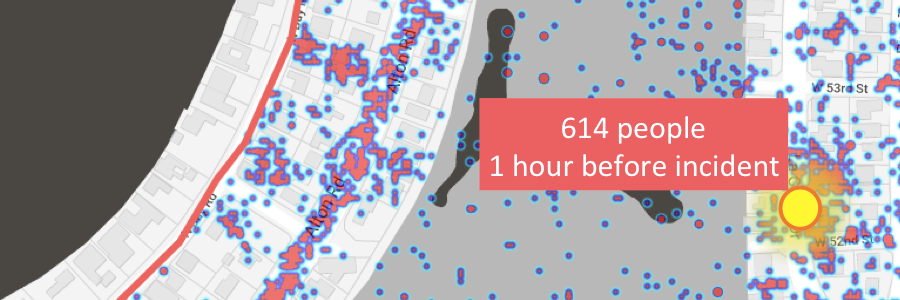
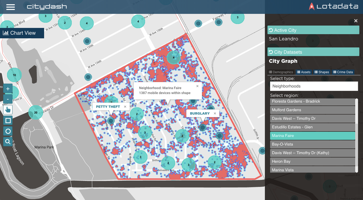
Cities are commonly inundated with 311 incident reports every day. A real-world knowledge graph can help cities evaluate the impact of a reported incident by providing a deeper understanding of how many people are in the vicinity of the incident at the time of occurrence and therefore might be impacted by it.
"Public safety impact analysis using real-world graphs can enhance critical decisions on resource deployment and response time, and also assist in deeper analysis for case investigation," said Steve Cercone, retired Chief of Police and President of SafeCitiesGlobal, an organization at the forefront of public safety, security and law enforcement worldwide
[2] People Mobility Flow Analysis

CityDash AI can help cities to move beyond people counting other people using tally counters. Real-world knowledge graphs like CityDash AI use mobile location intelligence to provide pre-computed people counts based on multi-layered geo shapes. Cities can also start to analyze something known as origin-destination analysis – where are people going to and from and why? An active graph for transit stations, neighborhoods and downtown districts can inform cities about where people came from, how long they stayed, and where they went after.
[3] IoT Grid Deployment Insights

Cities are making significant investments in high-quality IoT grids. A real-world knowledge graph based on alternative datasets can help cities to identify the optimal locations for installing IoT sensors and assets. For example, you can determine where to install cameras, EV charging stations, and other IT assets based on accurate heat maps of people presence, activity, and movement. The ground truth data collected by the IoT grid can feedback into the real-world knowledge graph, thereby creating a virtuous cycle.
[4] Economic Growth Measurement

Cities can measure the health of their economies by monitoring their retail and commercial zones. Where should developers build high-density housing or retail shopping centers? What is the best area for an industrial zone? A real-world knowledge graph with anonymized mobile location data can provide macro footfall analysis for commercial and industrial zones, as well as microanalysis for individual establishments, brands, and businesses. This has significant implications for economic development, urban planning, and zoning. Cities can then combine such data with other indicators like business licenses, tax returns, bankruptcy filings, and commercial space vacancies to evaluate the overall health of the local economy.
[5] City Events Engagement Analysis

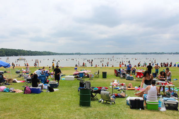
Finally, there are events and recreation planning implications. Public sector agencies organize hundreds of events every month, including festivals, sporting events, trade shows, rec classes, and conventions, while at the same time stewarding thousands of acres of public land in the form of parks and open spaces Cities. A real-world knowledge graph based on anonymized mobile location data can help you understand how people are engaging with all of these activities and spaces. For example, how many people visit your farmers’ markets? Are visitors to your parks trending up or down over the past year? What is the average attendance for summer camp events? You might even ask why the attendance was so abysmal for the Bucs-49ers game last week.
Then again, we don't really need AI to explain that last data point, do we?
Powered by CITYDATA.ai
CITYDATA.ai is a San Francisco based startup that has been featured in the GovTech 100 list for 2018, 2019, and 2020, an exclusive list of innovative companies that provide technology products and solutions for the public sector. We provides People Intelligence™ as a service for smarter cities and real-world businesses. By combining public and private data, our technology platform unlocks deep insights that were previously inaccessible to city departments. CITYDATA.ai makes it easy for city leaders to make data-driven decisions to create social impact and engage with local communities. Our AI platform, technology, and service are designed to make cities smarter, safer, and sustainable.


