33% more visits to the 2nd largest urban-adjacent park in the United States
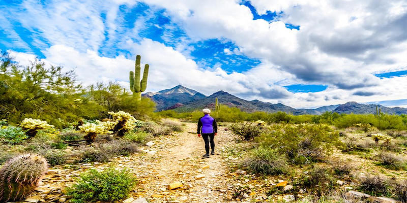
This blog posts delves into the footfall data insights and visits trends for Scottsdale's McDowell Sonoran Preserve in Maricopa County, Arizona.
Sign up for our webinars to learn from our data scientists and geospatial experts. They will show you how geospatial intelligence can be used in the most cost-effective way to measure, analyze and advocate local parks and open spaces.
America is blessed with an abundance of parks and open spaces. Our city planners did well to design and weave green spaces into our urban fabric.
Urban-adjacent parks offer endless opportunities for recreational activities in proximity of cities and towns. With the coronavirus outbreak still going strong, Americans eager to vacation safely are turning to urban-adjacent parks to enjoy large outdoor areas that would allow for physical distancing. Per the CDC, being physically active is one of the best ways to keep the mind and body healthy. In many areas, people can visit parks, trails, and open spaces as a way to relieve stress, get some fresh air and vitamin D, stay active, and safely connect with members of their community. While the number of people visiting parks dropped significantly during the first wave of the pandemic; the visits have started to increase as the country begins to recover from COVID-19.
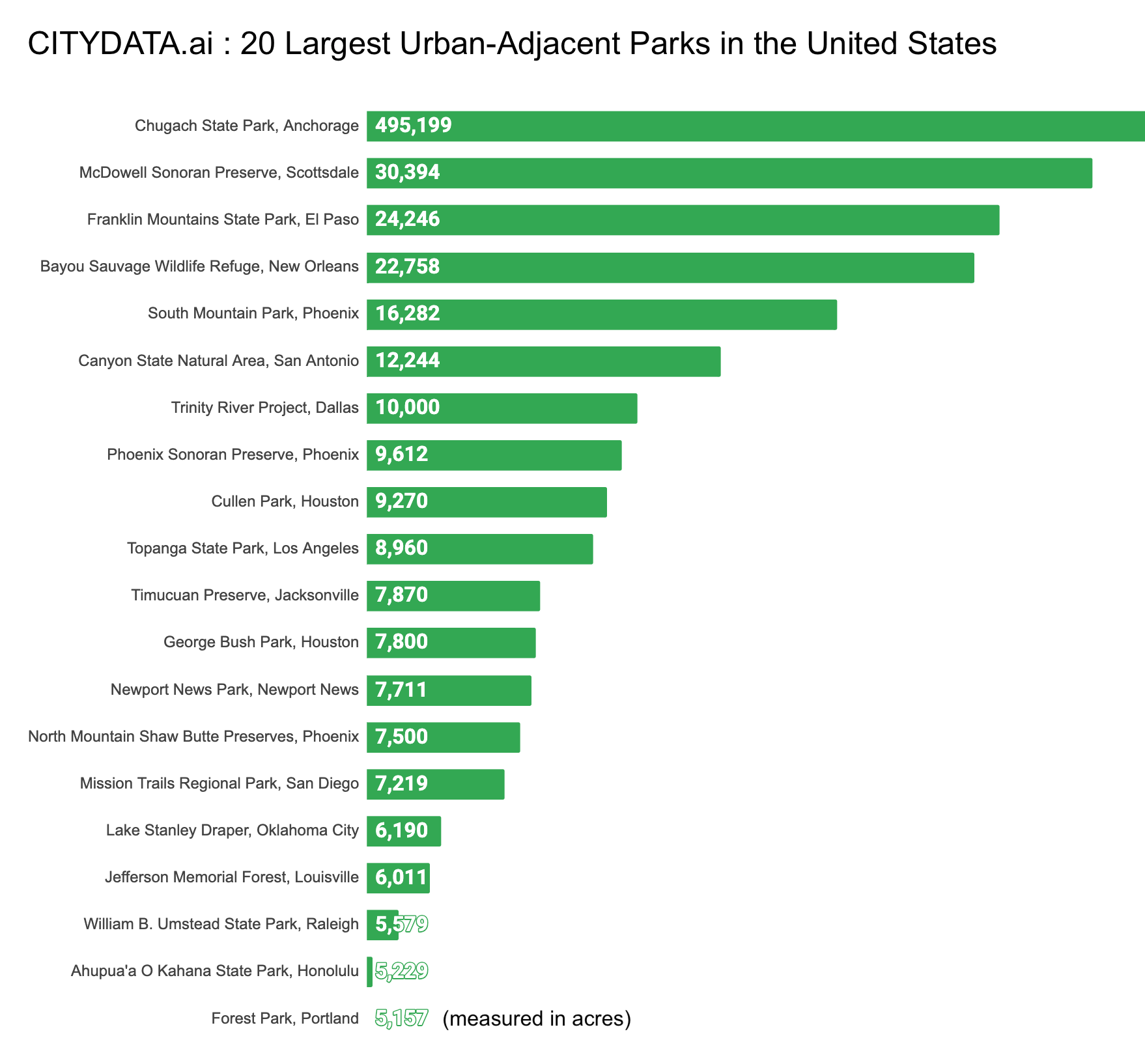
The below list published by CITYDATA.ai shows the top-20 urban-adjacent parks, open spaces, camp grounds and hiking trails that are adjacent to urban areas, ranked by land acres. For each park, CITYDATA.ai has crowdsourced anonymized data and aggregated the datasets to determine the footfall visit patterns, the average dwell time, the dispersion or movement patterns, and the changes over time both at the micro and macro level.
Google has put forth their Community Mobility Index to measure the activity at parks and open spaces across the United States and produced aggregated data reports. Geospatial data intelligence companies like CITYDATA.ai also are publishing their open data sets and visit insights for each neighborhood park, urban-adjacent park, regional park, and national park in the country.
The McDowell Sonoran Preserve in Scottsdale, Arizona is the second largest, permanently protected, sustainable desert habitat in the US, spanning over 30,500 contiguous acres with an interconnected network of 225 miles of non-motorized, multi-use trails accessed from 11 trailhead locations. The McDowell Sonoran Conservancy website indicates that the park is visited each year by approximately 750,000 people wishing to connect with nature. The park is usually open from sunrise to sunset and there is no charge for parking or access. However, due to COVID-19, the McDowell Sonoran Conservancy has suspended public activities that require the gathering of groups of people or close personal contact until renewed guidance from local, state and federal public health agencies allows for resumption of those activities.
CITYDATA.ai measured the density, activity, and movement of people at the McDowell Sonoran Preserve from January 2020 through September 2020 to study and understand the changes in visit patterns and activity levels. The panel from CITYDATA.ai represents over 45% of the resident population of Scottsdale. The data sample is statistically relevant and invaluable for the Recreation and Parks department. Such studies are also essential for public health officials and local administrators for their policy decisioning. Below are the results:
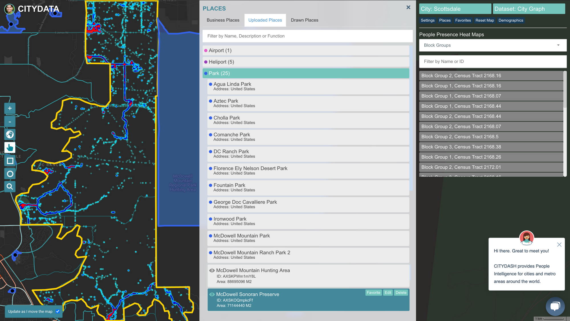


The above maps and charts tell a clear story. The visits to the McDowell Sonoran Preserve appear to have experienced a steeper drop than the overall reduction in visits to all parks and open spaces in Maricopa County, Arizona. While the number of people visiting the park dropped by a significant 65% during the first wave of the pandemic from January through June 2020; the visits have started to increase as the city begins to recover. CITYDATA.ai measured the density, activity, and movement of people to confirm that visits in September 2020 were 60% higher than in June 2020, 33% higher than July 2020, and are trending up again. The trend could reverse if we were to experience a stronger wave of the virus in the fall and winter.
Over the next few months, CITYDATA.ai plans to produce and publish the detailed maps and visit insights for the top-20 urban-adjacent parks and open spaces across the United States.
Recreate Responsibly
Visiting urban-adjacent parks or regional parks now is undoubtedly different than it was before the COVID-19 pandemic. One must remember to recreate responsibly when visiting wide-open spaces or exploring a historic urban neighborhood.
Most states and municipalities are following a phased approach to reopen park areas, beginning with outdoor spaces such as trails, boardwalks, observation decks, boat ramps, picnic areas, and other open landscapes. Some states are beginning to open enclosed areas such as visitor centers, historic homes, restrooms and other facilities. These areas are where maintaining social distancing is especially important.
Keep Your Social Distance
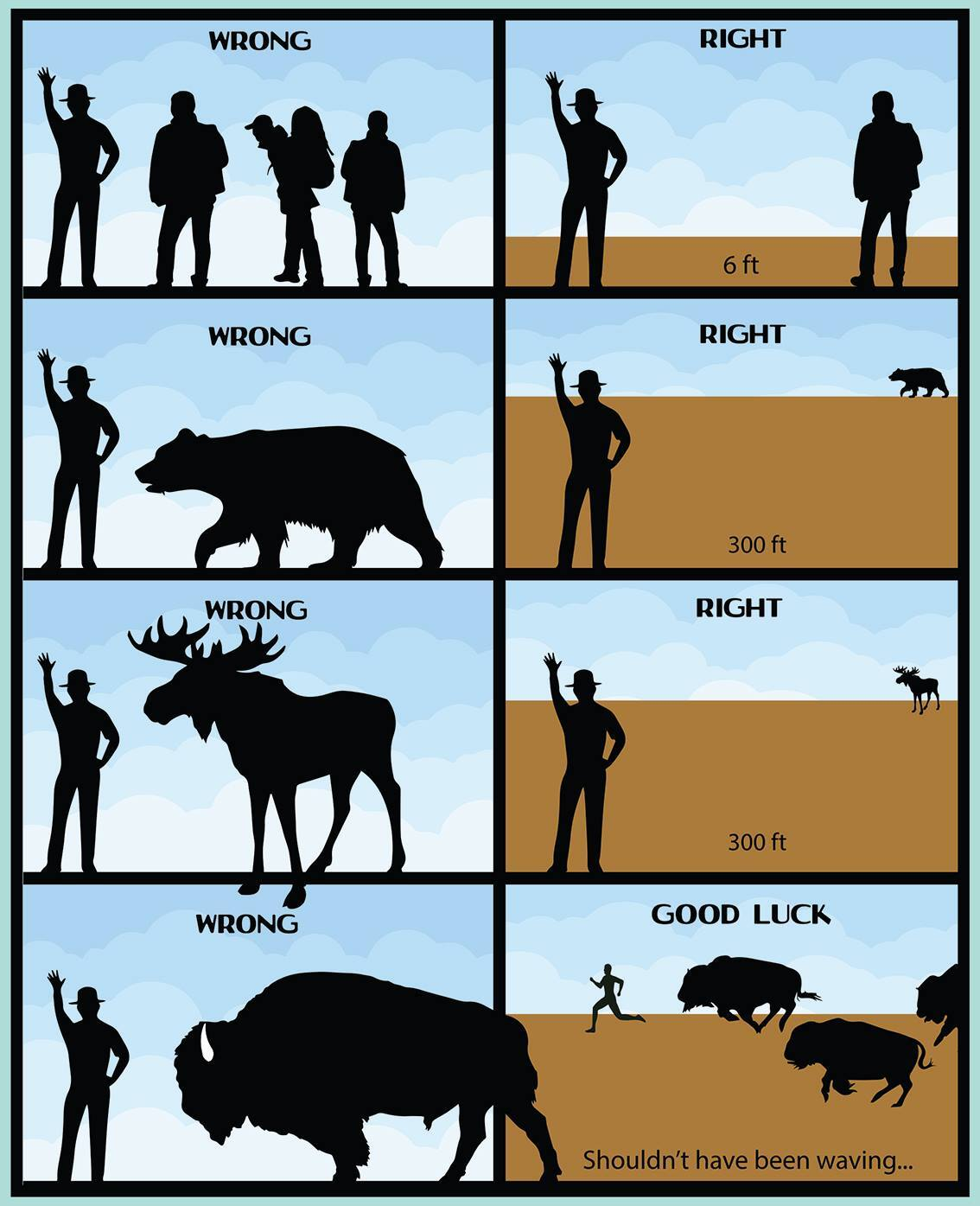
Public Health Agencies recommend wearing a mask in parks and following social distancing guidelines. Taking a rigorous walk in the fresh air is healthy, as long as it’s not in a group and people are spaced apart. Calling and checking with the park authorities or browsing their online website in advance can provide valuable information about which areas or services are open, such as visitors’ centers, bathroom facilities, and concessions, and the supplies that one must bring along to maintain proper hygiene, such as hand sanitizers.
At any large urban-adjacent park in the country, one must expect to be mingling with visitors from other cities and states that might be COVID-19 hot spots. For the safety of everyone, it is best to avoid crowded trails and indoor or enclosed spaces where it may not be possible to keep six feet of distance between park visitors and hikers. If the space is too crowded, consider turning around and finding another nearby trail.


