What defines a Neighborhood?

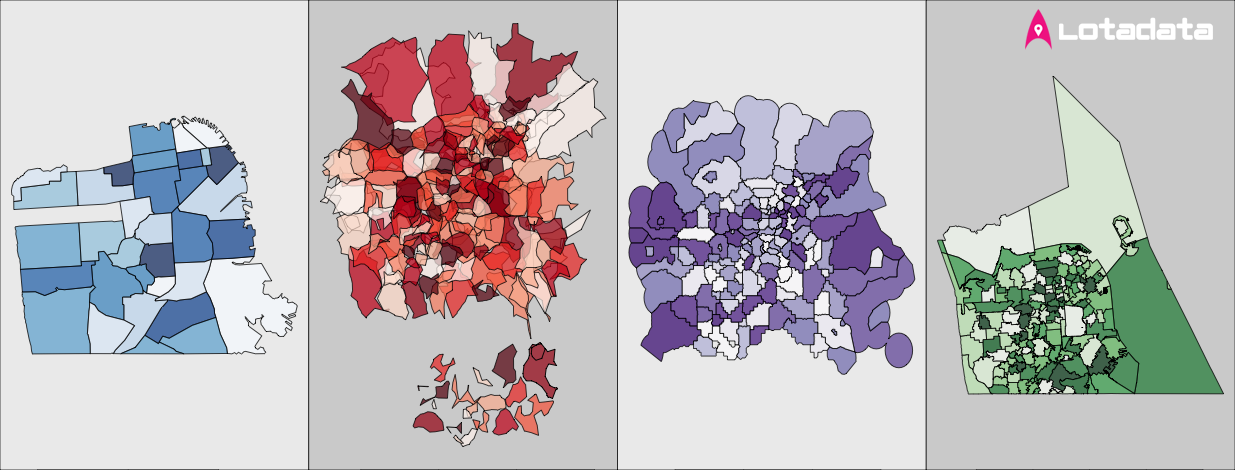
Pinpointing the composition, coordinates, and concept of a single neighborhood is a tough proposition. To understand these elements, we need more than simple data collection - we need a philosophical and sociological approach toward the definition.
Neighborhood Composition
Philosophically, something deeper than location ties a neighborhood together. After all, the area itself can be several square miles or just a couple of blocks. So aside from pure location, a neighborhood is identified by its unique people and their practices. By living in neighborhoods, we personally contribute to their composition. We set the ambiance, culture and social environment.
The more we can discover about a neighborhood's composition, the more we can understand a neighborhood's context and significance. Among other influences, we can use the commercial, ethnic, economic, racial, political, criminal and spiritual makeup of a community to provide fascinating insights into a neighborhood's active identity.
Neighborhood Coordinates
Spatially, the boundaries of a neighborhood are in perpetual flux. They shift with new waves of people and with changing industries. Nevertheless, neighborhoods are often able to maintain a semi-permanent locational existence. The Mission District in San Francisco, for instance, is as old as the city itself due to its ties to the 240-year-old Mission Dolores. Through time, its precise boundaries and composition have changed drastically, but it still exists in the same essential location.
On the opposite end of the San Francisco spectrum lies NoPa (North of Panhandle). It has grown out of the Western Addition neighborhood in only the past 5-10 years because of new commercial and residential changes. Now, it has formed an identity distinct enough to warrant recognition as its own neighborhood.

Neighborhood Concept
In light of these compositional and spatial considerations, we could view a neighborhood as a strict geo-temporal zone or as a critical mass of people with the same demographics. A balanced conception likely lies somewhere in between, somewhere with rough boundaries and a few common demographic threads.
Given these neighborhood complexities, collecting several sources of location-based data can clarify a neighborhood's real-world impact. Crowd-sourced neighborhood shapefiles will offer something substantially different than curated shapefiles from sources like Zillow. U.S. Census data will offer something far different than Facebook, Twitter, Yelp, and Instagram feeds. Mining and combining these ideologically separate sources can help us answer the conceptual and spatial neighborhood questions with greater nuance. They can help us see the neighborhood from many useful angles.
In my companion post, The Neighborhood Data Landscape, we will delve into the many data sources that LotaData takes into consideration for defining rich and relevant profiles for neighborhoods.
Until then, we welcome you to access our API or visually explore the neighborhoods across the US, zoom into your own neighborhood and discover the many attributes that define the place you call home.


