citysim
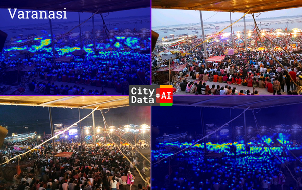
CitySim Predictive Flow Simulations in Varanasi, India
Authored by Dr. Pieter Fourie with Team CityData.AI
I am a big data and machine learning nerd who likes to solve real-world problems to make our cities more liveable, our communities more resilient, and our planet more sustainable.

citysim
Authored by Dr. Pieter Fourie with Team CityData.AI
uam
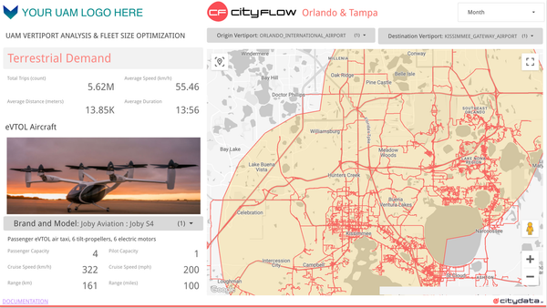
My previous blog post, "Ideal Take-off and Landing Spots for eVTOLs," explored the crucial first step in realizing the potential of Urban Air Mobility (UAM): identifying optimal locations for vertiports. We delved into the factors influencing vertiport placement, considering aspects like proximity to demand centers, airspace regulations,

parks and recreation
Understanding visitation patterns to various points of interest (POIs) like parks, trails, downtowns, business districts, shopping malls, restaurants, and individual businesses is crucial for urban planning, economic development, and tourism. Anonymized GPS crowdsourced data offers a rich source of information for measuring these visits and dwell times. However, this data
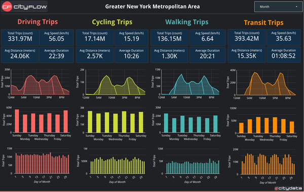
cityflow
Understanding city-wide mobility patterns is crucial for effective urban planning. CITYFLOW.ai leverages GPS mobility data to provide a powerful lens into these patterns. However, the data represents a sample of the population, not the entire city. This blog post delves into the technical process of scaling up trip